

What if the world map you grew up with was misleading you about Africa all along?
The United Nations General Assembly has adopted a resolution calling for the use of world maps that more accurately represent the true size of Africa.
The resolution, dubbed Correct the Map, was sponsored by Togo and backed by members of the African Union. It received support from 164 countries, including France and the United Kingdom, while the United States voted against it and six countries abstained.
Although the resolution is non-binding, it is expected to encourage institutions around the world to reconsider the use of the centuries-old Mercator projection.
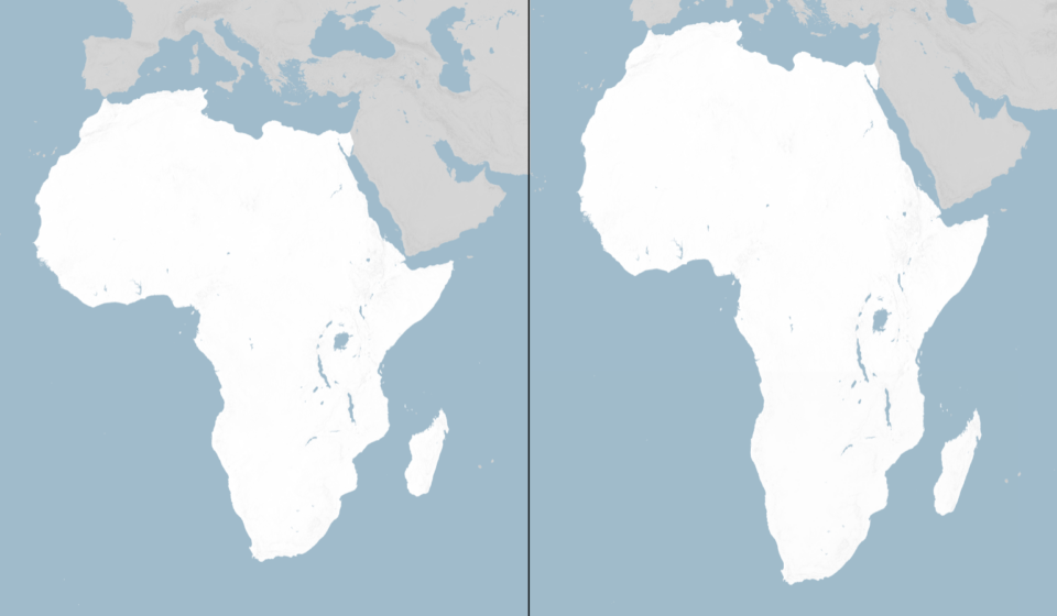
The Mercator projection, developed by Flemish cartographer Gerardus Mercator in 1569, significantly distorts the size of landmasses. Africa, for example, appears considerably smaller than its actual size and can appear comparable to Greenland, despite Africa being about 14 times larger.
The distortion occurs because a spherical Earth cannot be accurately represented on a flat map. The Mercator projection enlarges areas closer to the poles while shrinking the apparent size of regions around the equator.
In an effort to address the problem, cartographers developed the Equal Earth projection in 2018, which preserves the relative size of continents more accurately. The African Union’s 54 member states endorsed the projection in February, describing it as a more accurate representation of the size of Africa and other continents.
Togo’s Foreign Minister Robert Dussey, whose country sponsored the resolution, said the initiative was about correcting perceptions created by inaccurate maps.
A fair world begins with a fair map,” Dussey said.
He added that maps influence how people understand the importance and place of different continents in the world.
The initiative has also received support from France. Foreign Minister Jean-Noël Barrot said his ministry would stop using the Mercator projection, arguing that correcting distorted representations was an important step towards accuracy.
However, the United States opposed the resolution, with its representative to the UN, Yaryna Ferencevych, arguing that the General Assembly should focus on more pressing global challenges rather than historical map projections.
The campaign has gained momentum among African organisations, with Africa No Filter describing the inaccurate portrayal of the continent as more than a cartographic issue.
For Kenyan geographer Kioko Muendo, the continued use of distorted maps has contributed to an understated perception of Africa’s vast landmass, resources, population and economic potential.